With its advantages of fast, efficient, flexible and low cost, UAV tilt photography technology is slowly subverting the traditional surveying and mapping operation mode. It has become the “new darling†of the surveying and mapping industry. Applying tilt photography technology to drones is actually doing A three-dimensional model, and the model built is more realistic, more intuitive, and more realistic.
Stack measurement
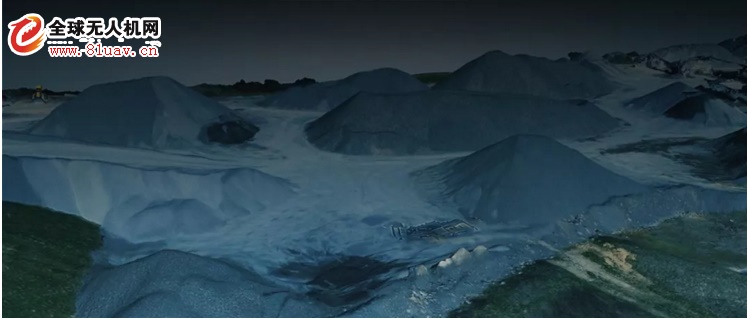
Data map / source network
The scope of application of stack measurement is very wide. The measurement of mound sand piles in mines, thermal power plants, construction projects, bulk cargo estimation at port terminals, and grain pile estimates in granaries are all inseparable from stack measurement. technology.
At present, the measurement of piles mainly relies on measuring instruments such as total station, disk coal meter and GPS to measure the pile. Compared with the measurement of the manual use of the tape measure earlier, these measurement methods have made great progress. However, today there are more efficient and accurate measurement methods: using drone mapping and modeling.
The drone can preset the route, collect data automatically in the work area, and after importing the data, it can be imported into the GIS system independently developed by the Qifei application, generate the point cloud and 3D model data in one click, and carry out the spatial distance and volume according to this. The measurement, or the simulation measurement of irregular stack area such as bevel, provides accurate numerical reference for engineering construction planning and production operations.
Tunnel pipeline monitoring
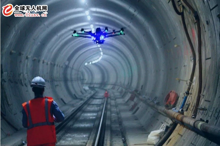
Data map / source network
The traditional subway, railway and automobile tunnel inspection requires the inspectors to go inside the tunnel and use manual inspection to confirm whether there are any abnormalities such as cracks or water leakage, and to ensure that there is no problem with the tunnel structure.
This method relies too much on manpower, is inefficient and has certain security risks. The subway, railway and automobile tunnels as traffic passages have very limited time for the inspection personnel, which further increases the difficulty of inspection.
UAVs equipped with high-definition cameras and laser radar and other detection equipment can collect high-precision image data in the tunnel and generate 3D models for viewing at any time. This not only provides higher inspection accuracy, but also allows engineers to have More time is focused on analyzing the data collected and quickly suggesting the countermeasures that need to be taken.
Highway surveying and mapping
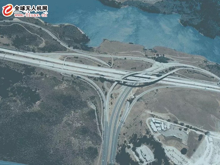
Data map / source network
For the maintenance and reconstruction of large-scale transportation infrastructure such as highways, the first step is to obtain clear image data of all road conditions.
This large task used to require manual or helicopter work to complete. Manual inspections take too long, and the cost of helicopter inspections is too high. In comparison, drones have many advantages such as low cost, high efficiency, high precision, etc., and are the best choice for road surveying and mapping.
The UAV mapping system for Qifei application integrates the UAV (fixed wing/multi-rotor), 3D modeling software and GIS application, and cooperates with the powerful workstation of Qifei application to complete the surveying and mapping work efficiently. It is also possible to accurately evaluate the engineering quantity of the road reconstruction through the GIS application software of the Kaifei application, and simulate the scene effect after the engineering transformation and the possible surrounding environmental impact, and provide strong support for the road reconstruction and road planning work of the highway department.
Modular Jack section
China Keystone Jack,Ethernet Wall Jack,Ethernet Wall Plate,Rj45 Keystone, we offered that you can trust. Welcome to do business with us.
RJ45 interface can be used to connect RJ-45 connectors. It is suitable for the network constructed by twisted pair. This port is the most common port, which is generally provided by Ethernet hub. The number of hubs we usually talk about is the number of RJ-45 ports.
RJ45 is a type of different connectors (for example: RJ11 is also a type of connector, but it is used on the telephone); there are two different ways to arrange the RJ-45 connector: one is white orange, orange, white green, blue, white blue, green, white brown, brown; the other is white green, green, white orange, blue, white blue, orange, white brown, brown; therefore, there are also wires with RJ45 connector There are two kinds: straight line and interleaved line.
The RJ-45 port of the hub can be directly connected to terminal devices such as computers and network printers, and can also be connected with other hub equipment and routers such as switches and hubs. It should be noted that when connecting to different devices, the jumper method of twisted pair cable used is different.
Keystone Jack,Ethernet Wall Jack,Ethernet Wall Plate,Rj45 Keystone
ShenZhen Antenk Electronics Co,Ltd , https://www.pcbsocket.com